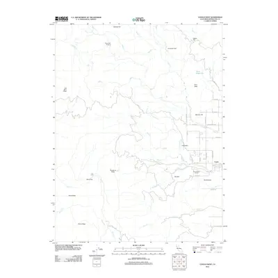
2012 Map of Covelo West
USGS Topo · Published 2012About this map
The mountain fringe of the Round Valley basin is the central focus of this Mendocino County survey, where the edge of Covelo meets the rising terrain of the northern Coast Ranges. The map documents the rural infrastructure supporting this isolated valley, including the Round Valley Airport and a network of local thoroughfares like the Charlie Hurt Hwy and Poonkinney Rd. High ridges such as Poonkinny Ridge and Gas Mine Ridge dominate the western horizon, interspersed with historically named clearings like Wylettie Flat and Davis Salt Ground. Drainage systems such as Grist Cr and Town Cr feed into the valley floor from the surrounding heights. This record of the early 21st century provides a look at the settlements of Little Valley and Cow Camp, capturing the remote character of the region before further modern developments.
Find a feature on this map
50 named features on this map. Tap any name to fly to it.
Don’t see what you’re looking for? This feature index may not catch every label — zoom into the map to look around manually.
Map Details
Editions of this 2012 Covelo West Map
This is the sole edition of this map. No revisions or reprints were ever made.
Other maps of this area

1920 · Covelo
USGS Topo · 1:62,500

1926 · Covelo
USGS Topo · 1:62,500

1929 · Eden Valley
USGS Topo · 1:62,500

1951 · Laytonville
USGS Topo · 1:62,500

1952 · Spyrock
USGS Topo · 1:62,500

1952 · Eden Valley
USGS Topo · 1:62,500

1952 · Covelo
USGS Topo · 1:62,500

1957 · Ukiah
USGS Topo · 1:250,000

1960 · Ukiah
USGS Topo · 1:250,000
1967 · Covelo West
USGS Topo · 1:24,000