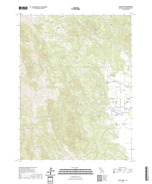
2021 Map of Covelo West
USGS Topo · Published 2021About this map
Covelo serves as the primary settlement hub for this portion of Round Valley, where the valley floor meets the rising peaks of the California Coast Ranges. The topography is defined by prominent family-named and descriptive landforms such as Poonkinny Ridge, Gas Mine Ridge, and Windy Ridge. This 2021 survey details the transition from the flat agricultural and residential lands near Round Valley Airport to the more remote upland flats like Wylettie Flat and Eberle Flat. Local history is anchored by the Valley View Cem and Pine Grove Cem, while the intricate drainage system including Grist Creek and Mill Cr illustrates the watershed patterns of the Eel River basin. The map tracks contemporary road networks from Foothill Blvd out to winding mountain routes like Mina Rd.
Find a feature on this map
61 named features on this map. Tap any name to fly to it.
Don’t see what you’re looking for? This feature index may not catch every label — zoom into the map to look around manually.
Map Details
Editions of this 2021 Covelo West Map
This is the sole edition of this map. No revisions or reprints were ever made.
Other maps of this area

1920 · Covelo
USGS Topo · 1:62,500

1926 · Covelo
USGS Topo · 1:62,500

1929 · Eden Valley
USGS Topo · 1:62,500

1951 · Laytonville
USGS Topo · 1:62,500

1952 · Spyrock
USGS Topo · 1:62,500

1952 · Eden Valley
USGS Topo · 1:62,500

1952 · Covelo
USGS Topo · 1:62,500

1957 · Ukiah
USGS Topo · 1:250,000

1960 · Ukiah
USGS Topo · 1:250,000
1967 · Covelo West
USGS Topo · 1:24,000