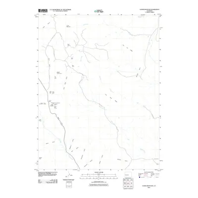
2010 Map of Cover Mountain
USGS Topo · Published 2010About this map
Mining operations and family ranchlands define this corner of the Colorado high country, where deep drainages like Mack Gulch and Wilson Creek cut through the granite landscape. The map reveals a dense concentration of mineral extraction sites southwest of Cover Mountain, including the Colorado Feldspar Company Mine, Climax Mica Mine, and the Star Girl Mine. These sites, alongside numerous prospects like the Whopper Mine, underscore the area's geological value for industrial minerals rather than precious metals.
Find a feature on this map
42 named features on this map. Tap any name to fly to it.
Don’t see what you’re looking for? This feature index may not catch every label — zoom into the map to look around manually.
Map Details
Editions of this 2010 Cover Mountain Map
This is the sole edition of this map. No revisions or reprints were ever made.
Other maps of this area

1894 · Pikes Peak
USGS Topo · 1:125,000

1901 · Pikes Peak
USGS Topo · 1:125,000

1942 · Cover Mtn.
USGS Topo · 1:62,500

1948 · Cover Mtn.
USGS Topo · 1:62,500

1954 · Pueblo
USGS Topo · 1:250,000

1957 · Pueblo
USGS Topo · 1:250,000

1958 · Pueblo
USGS Topo · 1:250,000

1959 · Black Mountain
USGS Topo · 1:62,500

1959 · Guffey
USGS Topo · 1:62,500
1959 · Florissant
USGS Topo · 1:62,500