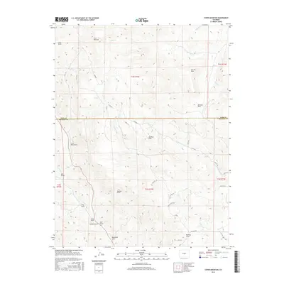
2016 Map of Cover Mountain
USGS Topo · Published 2016About this map
Cover Mountain stands as the dominant topographical landmark on this high-altitude landscape where the border between Park County and Fremont County is clearly delineated. The terrain is characterized by a complex drainage system flowing through deeply incised valleys, most notably High Cr and the extensive Wilson Cr network. These watercourses have carved out numerous named gulches that suggest a history of prospecting and local ranching, including Mill Gulch, Asher Gulch, and Horsethief Gulch.
Find a feature on this map
41 named features on this map. Tap any name to fly to it.
Don’t see what you’re looking for? This feature index may not catch every label — zoom into the map to look around manually.
Map Details
Editions of this 2016 Cover Mountain Map
This is the sole edition of this map. No revisions or reprints were ever made.
Other maps of this area

1894 · Pikes Peak
USGS Topo · 1:125,000

1901 · Pikes Peak
USGS Topo · 1:125,000

1942 · Cover Mtn.
USGS Topo · 1:62,500

1948 · Cover Mtn.
USGS Topo · 1:62,500

1954 · Pueblo
USGS Topo · 1:250,000

1957 · Pueblo
USGS Topo · 1:250,000

1958 · Pueblo
USGS Topo · 1:250,000

1959 · Black Mountain
USGS Topo · 1:62,500

1959 · Guffey
USGS Topo · 1:62,500
1959 · Florissant
USGS Topo · 1:62,500