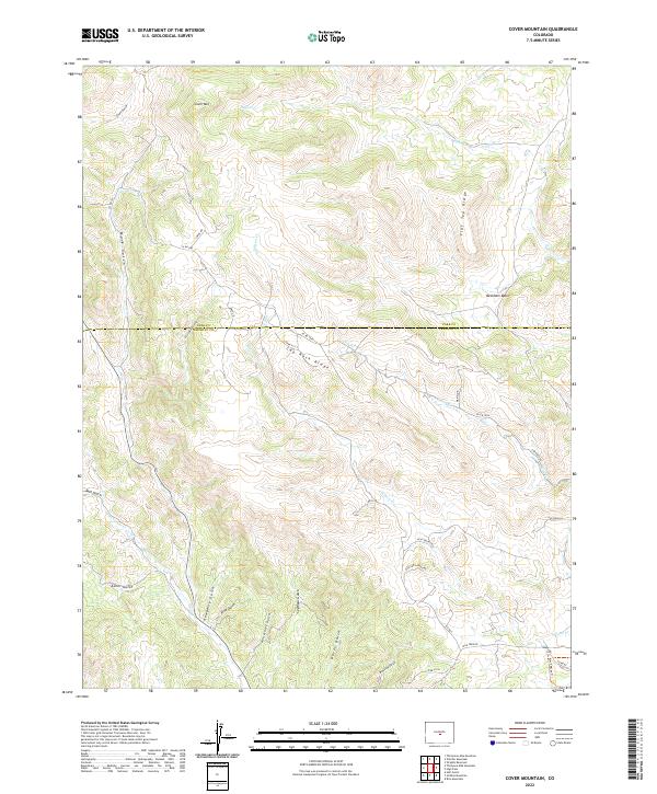
2022 Map of Cover Mountain
USGS Topo · Published 2022About this map
Cover Mtn stands as a prominent landmark in this high-altitude landscape along the border of Park and Fremont counties. The terrain is defined by a dense network of gulches and ridges that dictate the sparse human development of the area. Named features like Horsethief Gulch and Beckham Basin suggest a history of ranching and land use common to the Colorado high country. The map shows how modern access, via routes like Co RD 600 and Lodge Rd, follows the natural contours of the land, weaving between Cap Rock Ridge and Flat Top Ridge. Waterways such as High Cr and Wilson Cr flow through these steep valleys, while the presence of the Blm T5828a Trl indicates the area's contemporary role as public land managed for recreation and resource protection.
Find a feature on this map
43 named features on this map. Tap any name to fly to it.
Don’t see what you’re looking for? This feature index may not catch every label — zoom into the map to look around manually.
Map Details
Editions of this 2022 Cover Mountain Map
This is the sole edition of this map. No revisions or reprints were ever made.
Other maps of this area

1894 · Pikes Peak
USGS Topo · 1:125,000

1901 · Pikes Peak
USGS Topo · 1:125,000

1942 · Cover Mtn.
USGS Topo · 1:62,500

1948 · Cover Mtn.
USGS Topo · 1:62,500

1954 · Pueblo
USGS Topo · 1:250,000

1957 · Pueblo
USGS Topo · 1:250,000

1958 · Pueblo
USGS Topo · 1:250,000

1959 · Black Mountain
USGS Topo · 1:62,500

1959 · Guffey
USGS Topo · 1:62,500
1959 · Florissant
USGS Topo · 1:62,500