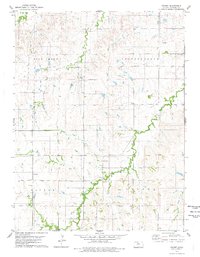
1978 Map of Covert
USGS Topo · Published 1979About this map
Covert and the surrounding townships of Victor, Kill Creek, and Independence define the rural character of this Osborne County landscape in the late 1970s. The topography is marked by the winding courses of Kill Creek, East Kill Creek, and Covert Creek, which carve through the plains. For researchers, the map provides precise locations for local heritage sites like the Bristow Cem and Covert Cem, alongside the small settlement of Dial. The presence of Oil Wells and scattered Gravel Pits points to the local extractive industries that supported the area's economy. The land is heavily partitioned, showing the persistent section lines and rural road networks that connect isolated homesteads to the community of Covert. Near the southern boundary, Cedar Bluff Cem sits atop the high ground overlooking the creek valleys.
Find a feature on this map
14 named features on this map. Tap any name to fly to it.
Don’t see what you’re looking for? This feature index may not catch every label — zoom into the map to look around manually.
Map Details
Editions of this 1978 Covert Map
This is the sole edition of this map. No revisions or reprints were ever made.
Other maps of this area

1896 · Osborne
USGS Topo · 1:125,000

1953 · Bloomington
USGS Topo · 1:24,000

1953 · Osborne
USGS Topo · 1:24,000

1953 · Alton
USGS Topo · 1:24,000

1955 · Beloit
USGS Topo · 1:250,000

1959 · Beloit
USGS Topo · 1:250,000

1978 · Osborne SW
USGS Topo · 1:24,000
1978 · Paradise NW
USGS Topo · 1:24,000
1978 · Alton SW
USGS Topo · 1:24,000
1978 · Vincent
USGS Topo · 1:24,000