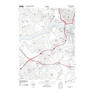
2010 Map of Covington
USGS Topo · Published 2010About this map
The Ohio River and Licking River define the core of this metropolitan landscape, where the urban density of Covington and Cincinnati meets the rising hills of Northern Kentucky and Western Ohio. On the Ohio side, neighborhood identities are firmly established in areas like Over-The-Rhine, West Price Hill, and the industrial valley of South Fairmount. The map reveals a legacy of resource extraction along the river bluffs, evidenced by several sites such as the Bald Knob Quarry and Wilder Quarry. In Kentucky, the terrain is characterized by suburban development spanning Fort Mitchell, Lakeside Park, and Erlanger. A high concentration of institutional landmarks and burial grounds, including the historic Potters Field, Saint Josephs Cemetery, and Highland Cemetery, provides significant detail for local historians. The proximity of the Public Landing to the downtown core highlights the enduring relationship between these cities and their riverfront commerce.
Find a feature on this map
147 named features on this map. Tap any name to fly to it.
Don’t see what you’re looking for? This feature index may not catch every label — zoom into the map to look around manually.
Map Details
Editions of this 2010 Covington Map
This is the sole edition of this map. No revisions or reprints were ever made.
Other maps of this area

1898 · East Cincinnati
USGS Topo · 1:62,500

1914 · East Cincinnati
USGS Topo · 1:62,500

1914 · West Cincinnati
USGS Topo · 1:62,500

1929 · Alexandria
USGS Topo · 1:48,000

1936 · Alexandria
USGS Topo · 1:62,500

1950 · Union
USGS Topo · 1:24,000

1950 · Independence
USGS Topo · 1:24,000

1950 · Covington
USGS Topo · 1:24,000

1951 · Burlington
USGS Topo · 1:24,000

1952 · Newport
USGS Topo · 1:24,000