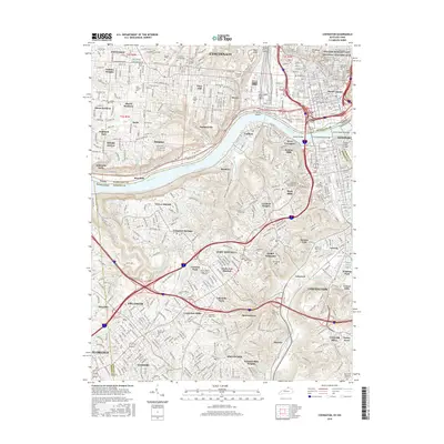
2016 Map of Covington
USGS Topo · Published 2016About this map
The Ohio River serves as the central artery for this densely populated corridor, where the urban centers of Cincinnati and Covington meet at the state line. This 2016 survey highlights the intricate bridge network connecting the two regions, including the iconic John A Roebling Bridge and the Spence Bridge. The map detail reveals the deep historic roots of the area through landmarks like the William Howard Taft National Historic Site and numerous large cemeteries such as Linden Grove Cem and Saint Josephs Cem.
Find a feature on this map
90 named features on this map. Tap any name to fly to it.
Don’t see what you’re looking for? This feature index may not catch every label — zoom into the map to look around manually.
Map Details
Editions of this 2016 Covington Map
This is the sole edition of this map. No revisions or reprints were ever made.
Other maps of this area

1898 · East Cincinnati
USGS Topo · 1:62,500

1914 · East Cincinnati
USGS Topo · 1:62,500

1914 · West Cincinnati
USGS Topo · 1:62,500

1929 · Alexandria
USGS Topo · 1:48,000

1936 · Alexandria
USGS Topo · 1:62,500

1950 · Union
USGS Topo · 1:24,000

1950 · Independence
USGS Topo · 1:24,000

1950 · Covington
USGS Topo · 1:24,000

1951 · Burlington
USGS Topo · 1:24,000

1952 · Newport
USGS Topo · 1:24,000