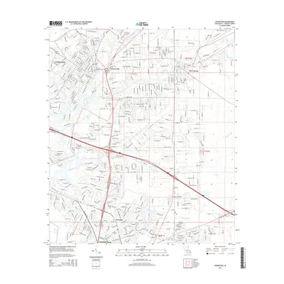
2015 Map of Covington
USGS Topo · Published 2015About this map
Bogue Falaya and the Tchefucte River converge just south of Covington, defining the hydrology of this St. Tammany Parish landscape. In the years following the millennium, the area shows a transition from the established street grids of Mandeville and Covington to the winding residential patterns surrounding Claiborne Hill. The Abita River and Ponchitolawa Creek traverse the central portion of the map, while Bayou Chinchuba and Bayou Tete L'Ours drain the southern reaches. Numerous burial sites including Wilson Cem, Abita Springs Cem., and Flat Cem provide points of interest for genealogists tracking local families. The settlement of Abita Springs stands as a distinct node to the east, connected by a network of numbered streets and avenues that reflect the steady expansion of the Northshore region.
Find a feature on this map
93 named features on this map. Tap any name to fly to it.
Don’t see what you’re looking for? This feature index may not catch every label — zoom into the map to look around manually.
Map Details
Editions of this 2015 Covington Map
This is the sole edition of this map. No revisions or reprints were ever made.
Other maps of this area

1935 · Slidell
USGS Topo · 1:62,500

1935 · Covington
USGS Topo · 1:62,500

1939 · Slidell
USGS Topo · 1:62,500

1939 · Covington
USGS Topo · 1:62,500

1942 · Onville
USGS Topo · 1:31,680

1942 · Waldheim
USGS Topo · 1:31,680

1942 · Talisheek
USGS Topo · 1:31,680

1950 · Slidell
USGS Topo · 1:62,500

1950 · Covington
USGS Topo · 1:62,500

1953 · Mobile
USGS Topo · 1:250,000