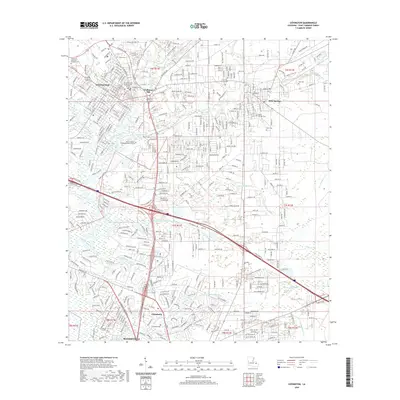
2020 Map of Covington
USGS Topo · Published 2020About this map
Covington and the surrounding piney woods of St. Tammany Parish are defined by the convergence of the Tchefuncte River and the Bogue Falaya. By 2020, the suburban growth of Mandeville and Abita Springs had significantly altered the landscape, yet the map preserves the location of numerous family and church burial grounds that speak to the area's older rural character. Key local sites include Claiborne Hill, the Saint Tammany Parish Justice Center, and the sprawling grounds of the Tulane National Primate Research Center. The map tracks several watercourses feeding the Ponchartrain basin, such as Ronchitolawa Creek, Abita River, and Bayou Chinchuba. This detailed survey offers researchers a look at how contemporary development has integrated with historic settlements like Chinchuba and established landmarks such as Oak Island.
Find a feature on this map
45 named features on this map. Tap any name to fly to it.
Don’t see what you’re looking for? This feature index may not catch every label — zoom into the map to look around manually.
Map Details
Editions of this 2020 Covington Map
This is the sole edition of this map. No revisions or reprints were ever made.
Other maps of this area

1935 · Slidell
USGS Topo · 1:62,500

1935 · Covington
USGS Topo · 1:62,500

1939 · Slidell
USGS Topo · 1:62,500

1939 · Covington
USGS Topo · 1:62,500

1942 · Onville
USGS Topo · 1:31,680

1942 · Waldheim
USGS Topo · 1:31,680

1942 · Talisheek
USGS Topo · 1:31,680

1950 · Slidell
USGS Topo · 1:62,500

1950 · Covington
USGS Topo · 1:62,500

1953 · Mobile
USGS Topo · 1:250,000