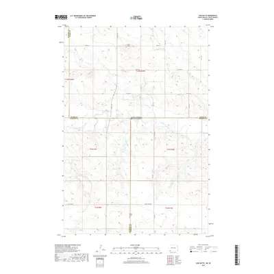
2018 Map of Cow Butte
USGS Topo · Published 2018About this map
The North Dakota South Dakota state line bisects this remote prairie landscape, where the high plains of Adams County meet the northern reaches of Harding County. This 2018 survey captures a region defined by its watercourses and prominent landforms, most notably the eponymous Cow Butte rising above the surrounding drainage basins. The North Fork Grand River meanders across the state boundary, supported by a network of seasonal streams including Buffalo Creek and Lightning Creek in the north and Horse Creek in the southern portion. Local heritage is anchored at the Golden Valley Cemetery near the junction of Harding and Perkins counties. The map reflects a structured township grid typical of the Great Plains, connected by established routes like Grassy Butte Road and Twin Township Road.
Find a feature on this map
23 named features on this map. Tap any name to fly to it.
Don’t see what you’re looking for? This feature index may not catch every label — zoom into the map to look around manually.
Map Details
Editions of this 2018 Cow Butte Map
This is the sole edition of this map. No revisions or reprints were ever made.
Other maps of this area

1935 · Reva
USGS Topo · 1:125,000

1953 · Dickinson
USGS Topo · 1:250,000

1954 · Lemmon
USGS Topo · 1:250,000

1957 · Dickinson
USGS Topo · 1:250,000

1957 · Lemmon
USGS Topo · 1:250,000

1968 · Haley
USGS Topo · 1:24,000

1968 · Ralph
USGS Topo · 1:24,000

1969 · Gascoyne
USGS Topo · 1:24,000

1969 · Reeder
USGS Topo · 1:24,000

1974 · Cow Butte
USGS Topo · 1:24,000