
1969 Map of Gascoyne
USGS Topo · Published 1971About this map
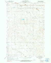
Gascoyne serves as the focal point for this Bowman County landscape, situated along the northern stretch of the Chicago Milwaukee St Paul and Pacific railroad. The layout of the late 1960s reveals a prairie economy defined by transportation and resource extraction, with a Strip Mine and multiple Gravel Pit locations marking the industrial footprint near the tracks. Water drainage follows the winding paths of Buffalo Creek and Lightning Creek, cutting through the undulating plains labeled as Haley, Goldfield, and Fischbein. The surveyor's notes from the margin credit Governor William L. Guy and chief engineer Milo W. Hoisveen, reflecting the state-led water commission efforts that shaped the region's development. Numerous bridge crossings like Br 2783 and Br 2730 suggest a maintained rural infrastructure supporting both the rail corridor and local ranching interests.
Find a feature on this map
20 named features on this map. Tap any name to fly to it.
Don’t see what you’re looking for? This feature index may not catch every label — zoom into the map to look around manually.
Map Details
Editions of this 1969 Gascoyne Map
2 editions found
Other maps of this area

1935 · Reva
USGS Topo · 1:125,000

1953 · Dickinson
USGS Topo · 1:250,000

1954 · Lemmon
USGS Topo · 1:250,000

1957 · Dickinson
USGS Topo · 1:250,000

1957 · Lemmon
USGS Topo · 1:250,000

1968 · Haley
USGS Topo · 1:24,000

1968 · Bowman-Haley Dam
USGS Topo · 1:24,000

1969 · Scranton
USGS Topo · 1:24,000

1969 · Reeder
USGS Topo · 1:24,000

1969 · Scranton NE
USGS Topo · 1:24,000