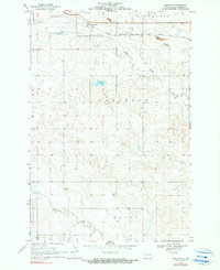
1969 Map of Gascoyne
USGS Topo · Published 1990About this map
Gascoyne serves as the focal point for this Bowman County landscape, situated along the vital corridor of the Chicago Milwaukee St Paul and Pacific railroad. The map reflects a rural economy rooted in both land stewardship and extractive industry during the late 1960s. North of the rail line, a Strip Mine and scattered Gravel Pit locations indicate the presence of local mineral resources. The terrain is defined by the winding paths of Buffalo Creek in the north and Lightning Creek to the south, which drain the surrounding plateaus. Named geographic areas such as Fischbein, Goldfield, and Haley provide essential reference points for local history and genealogy, documenting the traditional land divisions and regional nomenclature of this High Plains community.
Find a feature on this map
15 named features on this map. Tap any name to fly to it.
Don’t see what you’re looking for? This feature index may not catch every label — zoom into the map to look around manually.
Map Details
Editions of this 1969 Gascoyne Map
2 editions found
Other maps of this area

1935 · Reva
USGS Topo · 1:125,000

1953 · Dickinson
USGS Topo · 1:250,000

1954 · Lemmon
USGS Topo · 1:250,000

1957 · Dickinson
USGS Topo · 1:250,000

1957 · Lemmon
USGS Topo · 1:250,000

1968 · Haley
USGS Topo · 1:24,000

1968 · Bowman-Haley Dam
USGS Topo · 1:24,000

1969 · Scranton
USGS Topo · 1:24,000

1969 · Gascoyne
USGS Topo · 1:24,000

1969 · Reeder
USGS Topo · 1:24,000