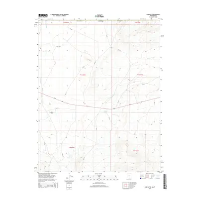
2014 Map of Cow Butte
USGS Topo · Published 2014About this map
Cow Butte rises as the primary landmark in this corner of Apache Co, Arizona, where a complex network of seasonal drainages and Bureau of Indian Affairs routes crisscross the desert. The landscape is defined by the hydrological patterns of Tsitah Wash and Toh Dahstini Wash, which flow across the high plateau. An essential water source, Toh Dahstini Spring, is located south of the butte, indicating the vital points of survival in this arid environment. Transportation through the region relies on Us-160, which cuts through the southern half of the quadrangle, and several local connectors like CO Road C47 and Bia-5035. The map also captures the path of Dry Farm Wash and Tso Tsosic Wash, showing how natural erosion and man-made roads negotiate the drainage basins of the Shiprock Agency area.
Find a feature on this map
27 named features on this map. Tap any name to fly to it.
Don’t see what you’re looking for? This feature index may not catch every label — zoom into the map to look around manually.
Map Details
Editions of this 2014 Cow Butte Map
This is the sole edition of this map. No revisions or reprints were ever made.
Other maps of this area

1886 · Abajo
USGS Topo · 1:250,000

1892 · Abajo
USGS Topo · 1:250,000

1892 · Canyon De Chelly
USGS Topo · 1:250,000

1893 · Abajo
USGS Topo · 1:250,000

1953 · Pastora Peak SW
USGS Topo · 1:24,000

1953 · Pastora Peak NW
USGS Topo · 1:24,000

1953 · Dinne Mesa NE
USGS Topo · 1:24,000

1953 · Pastora Peak NE
USGS Topo · 1:24,000

1953 · Dinne Mesa SE
USGS Topo · 1:24,000

1953 · Pastora Peak SE
USGS Topo · 1:24,000