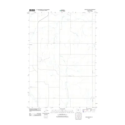
2012 Map of Cow Butte SW
USGS Topo · Published 2012About this map
Mud Butte stands as a prominent terrain feature in this corner of Harding County, anchoring a landscape defined by an intricate network of intermittent drainages. The hydrology of the area is characterized by the winding paths of Horse Cr in the north and the extensive reach of Fivemile Cr, which meanders southward toward Gooseneck Cr. This rural expanse is crisscrossed by a grid of section-line roads and designated routes such as Co Hwy-858 and Duck Creek Rd. The sparse settlement pattern and reliance on these named thoroughfares, including White Hill Rd and 113th St, reflect the enduring ranching and agricultural character of the South Dakota plains during the early 21st century.
Find a feature on this map
9 named features on this map. Tap any name to fly to it.
Don’t see what you’re looking for? This feature index may not catch every label — zoom into the map to look around manually.
Map Details
Editions of this 2012 Cow Butte SW Map
This is the sole edition of this map. No revisions or reprints were ever made.
Other maps of this area

1935 · Reva
USGS Topo · 1:125,000

1954 · Lemmon
USGS Topo · 1:250,000

1957 · Lemmon
USGS Topo · 1:250,000

1968 · Haley
USGS Topo · 1:24,000

1968 · Ralph
USGS Topo · 1:24,000

1969 · Reva NE
USGS Topo · 1:24,000

1974 · Cow Butte
USGS Topo · 1:24,000

1974 · Cow Butte NE
USGS Topo · 1:24,000

1980 · Camp Crook
USGS Topo · 1:100,000

1983 · Cow Butte SE
USGS Topo · 1:24,000