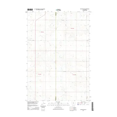
2015 Map of Cow Butte SW
USGS Topo · Published 2015About this map
Fivemile Cr and Horse Cr carve a network of drainage patterns across this High Plains landscape along the boundary of Harding Co and Perkins Co. This area of northwestern South Dakota is characterized by its wide-open topography and a sparse but essential road network that follows section lines and natural contours. Local travel and access are defined by gravel and dirt routes such as Ellingson Rd, Duck Creek Rd, and Ludlow Rd. Far to the southeast, Gooseneck Cr and White Hill Rd indicate the transition toward the neighboring hills. The map provides a look at the township and range system at work, with the intersections of t22n r9e and t21n r10e organizing the vast ranchland and rangeland in this part of the state.
Find a feature on this map
20 named features on this map. Tap any name to fly to it.
Don’t see what you’re looking for? This feature index may not catch every label — zoom into the map to look around manually.
Map Details
Editions of this 2015 Cow Butte SW Map
This is the sole edition of this map. No revisions or reprints were ever made.
Other maps of this area

1935 · Reva
USGS Topo · 1:125,000

1954 · Lemmon
USGS Topo · 1:250,000

1957 · Lemmon
USGS Topo · 1:250,000

1968 · Haley
USGS Topo · 1:24,000

1968 · Ralph
USGS Topo · 1:24,000

1969 · Reva NE
USGS Topo · 1:24,000

1974 · Cow Butte
USGS Topo · 1:24,000

1974 · Cow Butte NE
USGS Topo · 1:24,000

1980 · Camp Crook
USGS Topo · 1:100,000

1983 · Cow Butte SE
USGS Topo · 1:24,000