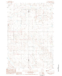
1983 Map of Cow Butte SW
USGS Topo · Published 1984About this map
Mud Butte and the surrounding high plains of South Dakota are captured here during a period of late-twentieth-century rural persistence. The landscape is defined by the drainage patterns of Horse Creek and Fivemile Creek, which carve through the terrain along the county line shared by Harding Co and Perkins Co. This map provides significant value for genealogists tracing family ties to the remote schoolhouses that served this ranching country, specifically the Ellingson Sch in the north and Swanson Sch to the south.
Find a feature on this map
9 named features on this map. Tap any name to fly to it.
Don’t see what you’re looking for? This feature index may not catch every label — zoom into the map to look around manually.
Map Details
Editions of this 1983 Cow Butte SW Map
This is the sole edition of this map. No revisions or reprints were ever made.
Other maps of this area

1935 · Reva
USGS Topo · 1:125,000

1954 · Lemmon
USGS Topo · 1:250,000

1957 · Lemmon
USGS Topo · 1:250,000

1968 · Haley
USGS Topo · 1:24,000

1968 · Ralph
USGS Topo · 1:24,000

1969 · Reva NE
USGS Topo · 1:24,000

1974 · Cow Butte
USGS Topo · 1:24,000

1974 · Cow Butte NE
USGS Topo · 1:24,000

1980 · Camp Crook
USGS Topo · 1:100,000

1983 · Cow Butte SE
USGS Topo · 1:24,000