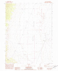
1982 Map of Cow Camp
USGS Topo · Published 1982About this map
Butte Valley defines the core of this landscape, reflecting the remote ranching and resource-extraction character of eastern Nevada in the early 1980s. The map highlights the essential water sources required for survival in this arid region, including Butte Spring and Robison Well, alongside several unimproved roads that navigate the basin. The presence of Cow Camp and various corral sites suggests the area’s primary use for livestock grazing. Evidence of industrial exploration and maintenance is visible through numerous drill holes and a gravel pit located on the eastern slopes, while the southern reaches contain an Old Well. This provisional survey is particularly useful for understanding the network of seasonal camps and water infrastructure that supported the local ranching economy before modern developments altered these traditional land-use patterns.
Find a feature on this map
11 named features on this map. Tap any name to fly to it.
Don’t see what you’re looking for? This feature index may not catch every label — zoom into the map to look around manually.
Map Details
Editions of this 1982 Cow Camp Map
This is the sole edition of this map. No revisions or reprints were ever made.
Other maps of this area

1956 · Ely
USGS Topo · 1:250,000

1959 · Ely
USGS Topo · 1:250,000
1962 · Hunter Point
USGS Topo · 1:24,000

1963 · Ely
USGS Topo · 1:250,000

1982 · Ninemile Well
USGS Topo · 1:24,000
1982 · Junction Well
USGS Topo · 1:24,000
1982 · Cabin Spring
USGS Topo · 1:24,000

1982 · White Sage Well
USGS Topo · 1:24,000
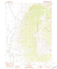
1982 · McBrides Sheep Well
USGS Topo · 1:24,000
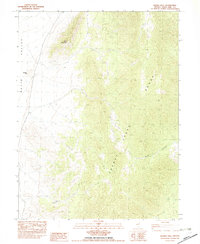
1982 · Franks Well
USGS Topo · 1:24,000