1962 Map of Hunter Point
USGS Topo · Published 1983About this map
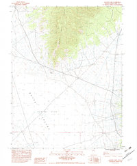
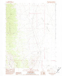
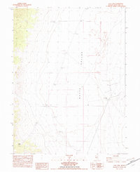
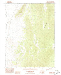
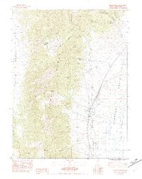
Cherry Creek Range rises sharply above the high desert floor in this detailed 1982 provisional study of White Pine County. The settlement at Hunter Point serves as a lone landmark where the mountain slopes meet the wide expanse of Butte Valley. The terrain transitions from the steep, contoured ridges of the range down into the open basin of Hunter Flat, reflecting the characteristic basin-and-range geography of eastern Nevada. Human activity is sparsely recorded here, evidenced by a solitary Prospect and the infrastructure of Hunter Tank at the edge of the valley. This survey was compiled from aerial photography taken in the mid-1970s, capturing the remote landscape before modern digital revisions.
Find a feature on this map
7 named features on this map. Tap any name to fly to it.
Don’t see what you’re looking for? This feature index may not catch every label — zoom into the map to look around manually.
Map Details
Editions of this 1962 Hunter Point Map
This is the sole edition of this map. No revisions or reprints were ever made.
Other maps of this area

1956 · Ely
USGS Topo · 1:250,000

1959 · Ely
USGS Topo · 1:250,000

1963 · Ely
USGS Topo · 1:250,000
1982 · White Sage Well
USGS Topo · 1:24,000
1982 · Cow Camp
USGS Topo · 1:24,000
1982 · Franks Well
USGS Topo · 1:24,000
1982 · Steptoe Ranch
USGS Topo · 1:24,000
1982 · Telegraph Peak
USGS Topo · 1:24,000
1982 · Egan Canyon
USGS Topo · 1:24,000
1982 · Thirtymile Ranch
USGS Topo · 1:24,000