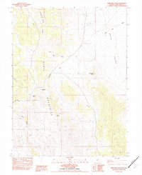
1982 Map of Thirtymile Ranch
USGS Topo · Published 1982About this map
Thirtymile Ranch serves as the central focal point in this high-desert basin of eastern Nevada, situated between the prominence of Sugarloaf and the expansive Butte Valley. The map reveals a landscape defined by its vital water sources, including Gracian Well, Silver Tank, and Summit Spring, which were essential for ranching operations in this arid environment. Topographical features like Red Pepper Butte and the rugged cuts of Burnt Canyon and Long Valley Canyon illustrate the isolation and environmental challenges of the region. The network of washes, such as White Sage Wash and Thirtymile Wash, along with the curiously named Robbers Roost, suggests a history of transient movement through the Mountains. This 1982 provisional edition captures the footprint of rural life in Butte and Butte Valley before modern changes altered these traditional land uses.
Find a feature on this map
17 named features on this map. Tap any name to fly to it.
Don’t see what you’re looking for? This feature index may not catch every label — zoom into the map to look around manually.
Map Details
Editions of this 1982 Thirtymile Ranch Map
This is the sole edition of this map. No revisions or reprints were ever made.
Other maps of this area

1951 · Illipah
USGS Topo · 1:62,500

1956 · Ely
USGS Topo · 1:250,000

1959 · Ely
USGS Topo · 1:250,000

1959 · Reipetown
USGS Topo · 1:62,500
1962 · Hunter Point
USGS Topo · 1:24,000

1963 · Ely
USGS Topo · 1:250,000

1979 · Mt. Hamilton
USGS Topo · 1:100,000

1982 · White Sage Well
USGS Topo · 1:24,000
1982 · McBrides Sheep Well
USGS Topo · 1:24,000

1982 · Dickenson Well
USGS Topo · 1:24,000