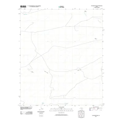
2010 Map of Cow Mountain
USGS Topo · Published 2010About this map
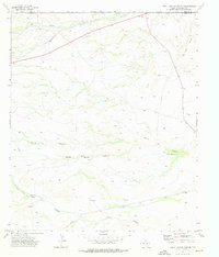
Cow Mountain dominates the eastern horizon of this high-desert landscape in Culberson County, where the dry drainage of Willow Draw cuts across the center of the sheet. The terrain is defined by the vital importance of water management in a ranching environment, marked by isolated points of interest such as the Gray Windmill and several catchment basins including Middle Tank, Division Tank, and Tank Number Twelve. In the northern portion of the quadrangle, the Delaware River winds through Lamar Canyon, providing a rare perennial or seasonal waterway in an otherwise arid expanse. The infrastructure is sparse, primarily consisting of the east-west route of F M 1108 and the north-south alignment of University Rd, which facilitate movement between the cattle tanks and topographic landmarks that define the region's rural character.
Find a feature on this map
10 named features on this map. Tap any name to fly to it.
Don’t see what you’re looking for? This feature index may not catch every label — zoom into the map to look around manually.
Map Details
Editions of this 2010 Cow Mountain Map
This is the sole edition of this map. No revisions or reprints were ever made.
Other maps of this area

1954 · Van Horn
USGS Topo · 1:250,000

1958 · Van Horn
USGS Topo · 1:250,000

1973 · Seven L Peak
USGS Topo · 1:24,000

1973 · Chico Draw East
USGS Topo · 1:24,000

1973 · Cow Mountain
USGS Topo · 1:24,000

1973 · Delaware Spring
USGS Topo · 1:24,000
1973 · Long Point
USGS Topo · 1:24,000
1973 · Chico Draw West
USGS Topo · 1:24,000
1973 · Independence Spring
USGS Topo · 1:24,000
1973 · South Rector Canyon
USGS Topo · 1:24,000