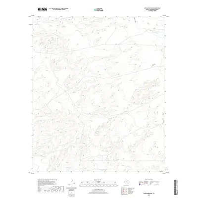
2019 Map of Cow Mountain
USGS Topo · Published 2019About this map
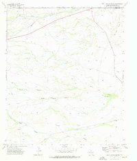
The Delaware River cuts through this high-desert corner of West Texas, winding past Cow Mtn in a landscape defined by its scarce water resources. Ranching infrastructure is a prominent feature of this Culberson County survey, marked by essential watering points such as Middle Tank, Division Tank, and Tank Number Twelve. These man-made features underscore the necessity of water management in an area otherwise dominated by the seasonal drainage of Willow Draw and the steep terrain of Lamar Canyon. Transportation is limited to a handful of routes, including FM 1108 and University Rd, which navigate the high-elevation contours of the Trans-Pecos region.
Find a feature on this map
9 named features on this map. Tap any name to fly to it.
Don’t see what you’re looking for? This feature index may not catch every label — zoom into the map to look around manually.
Map Details
Editions of this 2019 Cow Mountain Map
This is the sole edition of this map. No revisions or reprints were ever made.
Other maps of this area

1954 · Van Horn
USGS Topo · 1:250,000

1958 · Van Horn
USGS Topo · 1:250,000

1973 · Seven L Peak
USGS Topo · 1:24,000

1973 · Chico Draw East
USGS Topo · 1:24,000

1973 · Cow Mountain
USGS Topo · 1:24,000

1973 · Delaware Spring
USGS Topo · 1:24,000
1973 · Long Point
USGS Topo · 1:24,000
1973 · Chico Draw West
USGS Topo · 1:24,000
1973 · Independence Spring
USGS Topo · 1:24,000
1973 · South Rector Canyon
USGS Topo · 1:24,000