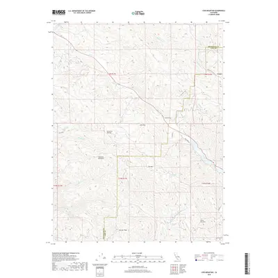
2018 Map of Cow Mountain
USGS Topo · Published 2018About this map
Mayacmas Mountains terrain dominates this 2018 survey of the border between Mendocino and Lake Counties. The landscape is defined by the high ridges of Cow Mtn and Little Cow Mtn, divided by drainages like Scotts Cr and N Fork Mill Cr. In the northeastern corner, the small settlement of Cooper sits near the headwaters of Mewhinney Cr, while the elongated Blue Lakes provide a striking visual break in the topography. A narrow passage known as The Narrows connects these water bodies, which are flanked by the winding Blue Lakes Rd. Notable landmarks for hikers and local historians include the Glen Eden Trl and Forty-Acre Opening, alongside numerous remote water sources such as Black Oak Springs. The map reveals a transition from these high peaks to the Bachelor Valley, illustrating the complex watershed system that feeds into Sulphur Creek and Cold Cr.
Find a feature on this map
35 named features on this map. Tap any name to fly to it.
Don’t see what you’re looking for? This feature index may not catch every label — zoom into the map to look around manually.
Map Details
Editions of this 2018 Cow Mountain Map
This is the sole edition of this map. No revisions or reprints were ever made.
Other maps of this area

1920 · Ukiah
USGS Topo · 1:62,500

1922 · Hullville
USGS Topo · 1:62,500

1938 · Lakeport
USGS Topo · 1:62,500

1943 · Pomo
USGS Topo · 1:62,500

1944 · Ukiah
USGS Topo · 1:62,500

1951 · Lake Pillsbury
USGS Topo · 1:62,500

1951 · Lakeport
USGS Topo · 1:62,500

1957 · Ukiah
USGS Topo · 1:250,000
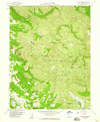
1958 · Purdys Gardens
USGS Topo · 1:24,000

1958 · Ukiah
USGS Topo · 1:24,000