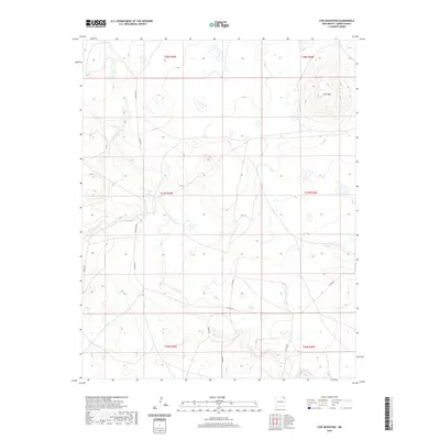
2020 Map of Cow Mountain
USGS Topo · Published 2020About this map
Cow Mtn dominates the northeastern corner of this high plains landscape in Union County, where the terrain is defined by a sparse network of county roads and intermittent waterways. The drainage patterns of Gallegos Cr and Carrizo Cr cut across the landscape, illustrating the hydrological character of this portion of New Mexico. Local transport and land access are delineated by a grid of rural routes including Gallegos Rd, Biffle Rd, and Jones Rd. This survey highlights the Public Land Survey System divisions, showing the intersection of Townships 26, 27, and 28 North across Ranges 29 and 30 East. The map captures a largely open, ranching-oriented environment where topographical contours reveal the subtle rises and depressions characteristic of the region beyond the prominent silhouette of the mountain.
Find a feature on this map
15 named features on this map. Tap any name to fly to it.
Don’t see what you’re looking for? This feature index may not catch every label — zoom into the map to look around manually.
Map Details
Editions of this 2020 Cow Mountain Map
This is the sole edition of this map. No revisions or reprints were ever made.
Other maps of this area

1954 · Dalhart
USGS Topo · 1:250,000

1958 · Dalhart
USGS Topo · 1:250,000

1962 · Dalhart
USGS Topo · 1:250,000

1972 · Little Grande
USGS Topo · 1:24,000

1972 · Capulin
USGS Topo · 1:24,000

1972 · Malpie Mountain
USGS Topo · 1:24,000

1972 · Cow Mountain
USGS Topo · 1:24,000
1973 · Wetherly Lake
USGS Topo · 1:24,000

1973 · Gladstone NW
USGS Topo · 1:24,000

1973 · Grenville SW
USGS Topo · 1:24,000