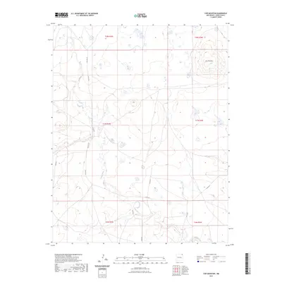
2023 Map of Cow Mountain
USGS Topo · Published 2023About this map
Cow Mountain rises as the central landmark in this high-plains landscape of northeast New Mexico. The terrain is defined by the winding drainages of Gallegos Creek and Carrizo Creek, which carve through the open range. This modern topographic study shows a vast, sparsely settled territory primarily used for ranching and agriculture, where movement is dictated by a network of rural roads such as Gallegos Rd and Biffle Rd. The map detail captures the remote character of Union County, tracing the legacy of the Public Land Survey System through its township and range boundaries. For researchers, the presence of isolated water sources and long-established gravel routes like Jones Rd provides a clear view of the infrastructure supporting this corner of the state.
Find a feature on this map
15 named features on this map. Tap any name to fly to it.
Don’t see what you’re looking for? This feature index may not catch every label — zoom into the map to look around manually.
Map Details
Editions of this 2023 Cow Mountain Map
This is the sole edition of this map. No revisions or reprints were ever made.
Other maps of this area

1954 · Dalhart
USGS Topo · 1:250,000

1958 · Dalhart
USGS Topo · 1:250,000

1962 · Dalhart
USGS Topo · 1:250,000

1972 · Little Grande
USGS Topo · 1:24,000

1972 · Capulin
USGS Topo · 1:24,000

1972 · Malpie Mountain
USGS Topo · 1:24,000

1972 · Cow Mountain
USGS Topo · 1:24,000
1973 · Wetherly Lake
USGS Topo · 1:24,000

1973 · Gladstone NW
USGS Topo · 1:24,000

1973 · Grenville SW
USGS Topo · 1:24,000