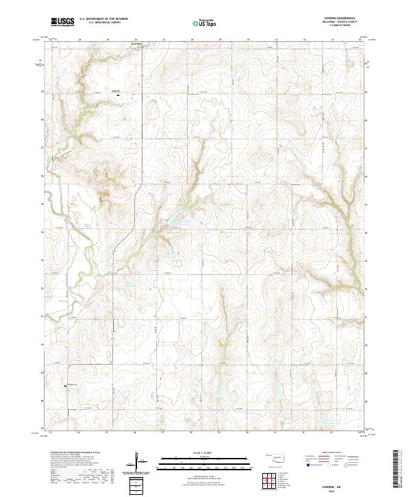
2022 Map of Cowden
USGS Topo · Published 2022About this map
Cowden serves as the northern focal point in this agricultural landscape of Washita County, where the plains are deeply dissected by the Washita River and its numerous tributaries. The terrain is defined by a systematic grid of section-line roads, such as E 1250 Rd and N 2410 Rd, which navigate around significant water management features like the Cowden Laterals Site 4 Reservoir and Cowden Laterals Site 7 Reservoir. These reservoirs and the drainage basins of Spring Creek and Cottonwood Creek illustrate the regional reliance on controlled water systems for ranching and farming. For those researching local history or genealogy, the map identifies specific burial sites including Sappington Chapel Cemetery in the north and Oakdale Cemetery further south, providing exact locations for family heritage sites within the rural landscape.
Find a feature on this map
34 named features on this map. Tap any name to fly to it.
Don’t see what you’re looking for? This feature index may not catch every label — zoom into the map to look around manually.
Map Details
Editions of this 2022 Cowden Map
This is the sole edition of this map. No revisions or reprints were ever made.
Other maps of this area

1955 · Clinton
USGS Topo · 1:250,000

1956 · Cordell
USGS Topo · 1:62,500

1957 · Clinton
USGS Topo · 1:250,000

1961 · Gotebo
USGS Topo · 1:62,500

1961 · Eakly
USGS Topo · 1:62,500

1961 · Carnegie
USGS Topo · 1:62,500

1983 · Cloud Chief
USGS Topo · 1:24,000

1984 · Gotebo East
USGS Topo · 1:24,000

1984 · Eakly
USGS Topo · 1:24,000
1984 · Colony
USGS Topo · 1:24,000