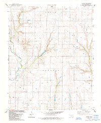
1984 Map of Cowden
USGS Topo · Published 1985About this map
The Washita River cuts through the western portion of this Washita County landscape, anchoring a network of drainage systems including Gyp Creek, Spring Creek, and Cottonwood Creek. Published in the mid-1980s based on data from 1958 and 1981, the map reveals a rural Oklahoma territory defined by agricultural section lines and an active energy economy. The settlement of Cowden sits in the northern reaches, while the terrain reflects the importance of natural resource extraction through numerous wells, a Gas Well, and several drill holes scattered across the Oakdale and Seger regions. For local historians and genealogists, the map provides precise locations for the Sappington Chapel Cem and Oakdale Cem, serving as critical markers of the area's early community centers.
Find a feature on this map
18 named features on this map. Tap any name to fly to it.
Don’t see what you’re looking for? This feature index may not catch every label — zoom into the map to look around manually.
Map Details
Editions of this 1984 Cowden Map
This is the sole edition of this map. No revisions or reprints were ever made.
Other maps of this area

1955 · Clinton
USGS Topo · 1:250,000

1956 · Cordell
USGS Topo · 1:62,500

1957 · Clinton
USGS Topo · 1:250,000

1961 · Gotebo
USGS Topo · 1:62,500

1961 · Eakly
USGS Topo · 1:62,500

1961 · Carnegie
USGS Topo · 1:62,500

1983 · Cloud Chief
USGS Topo · 1:24,000

1984 · Gotebo East
USGS Topo · 1:24,000

1984 · Eakly
USGS Topo · 1:24,000
1984 · Colony
USGS Topo · 1:24,000