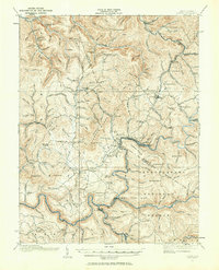
1915 Map of Cowen
USGS Topo · Published 1964About this map
Deep-cut river valleys and high knobs define the West Virginia landscape at the edge of the Monongahela National Forest in this 1915 survey. The Baltimore and Ohio RR follows the winding path of the Gauley River, anchoring industrial hubs like Gauley Mills and Camden on Gauley. The map reveals a high density of rural schools, including Locust Grove School and Pine Grove School, serving isolated mountain settlements. Small post offices and stations like Hale Sta Marcus PO and Woodbine PO mark the community centers of the era. The presence of Coal Siding along the rail line near Curtin indicates the importance of timber and mineral extraction to the local economy. Higher elevations are marked by distinctive landmarks like Cottle Knob and Chestnut Knob, while the intricate drainage systems of Muddlety Creek and Birch River carve out the rugged topography of Webster and Nicholas counties.
Find a feature on this map
113 named features on this map. Tap any name to fly to it.
Don’t see what you’re looking for? This feature index may not catch every label — zoom into the map to look around manually.
Map Details
Editions of this 1915 Cowen Map
3 editions found

Other maps of this area

1889 · Nicholas
USGS Topo · 1:125,000

1891 · Nicholas
USGS Topo · 1:125,000

1891 · Huntersville
USGS Topo · 1:125,000

1893 · Buckhannon
USGS Topo · 1:125,000

1893 · Sutton
USGS Topo · 1:125,000

1894 · Huntersville
USGS Topo · 1:125,000

1896 · Buckhannon
USGS Topo · 1:125,000

1897 · Buckhannon
USGS Topo · 1:125,000

1901 · Nicholas
USGS Topo · 1:125,000

1908 · Gassaway
USGS Topo · 1:48,000