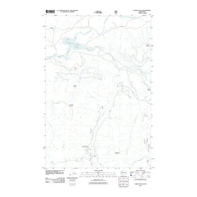
2011 Map of Cowlitz Falls
USGS Topo · Published 2011About this map
Lake Scanewa sits at the confluence of the Cowlitz River and Cispus River, serving as a central hub for the water systems in this part of Lewis County. The landscape is defined by its dramatic relief, moving from the river basins up to the heights of Huffaker Mountain and Strawberry Mountain. Historically a corridor for travel and early settlement, the area around Cispus and the Kelly Ranch reflects the region's transition into a space primarily used for timber management and outdoor recreation. The network of Forest Service roads, such as Nat For Dev Rd 2742, provides access to significant natural landmarks like Copper Canyon and Tumwater Mountain. Cultural and environmental preservation is evident at the Quartz Creek Big Trees Campground, while the Cowlitz Falls represents a key point of interest along the upper river system.
Find a feature on this map
33 named features on this map. Tap any name to fly to it.
Don’t see what you’re looking for? This feature index may not catch every label — zoom into the map to look around manually.
Map Details
Editions of this 2011 Cowlitz Falls Map
This is the sole edition of this map. No revisions or reprints were ever made.
Other maps of this area

1919 · Mount St Helens
USGS Topo · 1:125,000

1924 · Mt Rainier
USGS Topo · 1:96,000

1926 · Steamboat Mtn
USGS Topo · 1:125,000

1928 · Mt Rainier
USGS Topo · 1:125,000

1931 · Steamboat Mtn
USGS Topo · 1:125,000

1937 · Eatonville
USGS Topo · 1:125,000

1950 · Yakima
USGS Topo · 1:250,000

1953 · Hoquiam
USGS Topo · 1:250,000

1956 · Mineral
USGS Topo · 1:62,500

1957 · Hoquiam
USGS Topo · 1:250,000