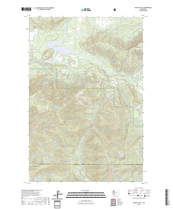
2023 Map of Cowlitz Falls
USGS Topo · Published 2023About this map
The Cowlitz River and Cispus River converge here, feeding into the prominent waters of Lake Scanewa. This mountainous region of Lewis County is defined by its massive vertical relief and protected lands, notably the Gifford Pinchot National Forest and a portion of the Mount Saint Helens National Volcanic Monument. The tiny settlement of Cispus sits near the northern boundary, while the interior is dominated by peaks like Tumwater Mtn and Huffaker Mtn. A network of backcountry access points, including the Deep Lake Trl and Strawberry Mountain Trl, provides passage through deep drainage systems such as Copper Canyon and along Quartz Creek. The map documents a landscape where modern forest management and volcanic conservation intersect along high-elevation ridges.
Find a feature on this map
35 named features on this map. Tap any name to fly to it.
Don’t see what you’re looking for? This feature index may not catch every label — zoom into the map to look around manually.
Map Details
Editions of this 2023 Cowlitz Falls Map
This is the sole edition of this map. No revisions or reprints were ever made.
Other maps of this area

1919 · Mount St Helens
USGS Topo · 1:125,000

1924 · Mt Rainier
USGS Topo · 1:96,000

1926 · Steamboat Mtn
USGS Topo · 1:125,000

1928 · Mt Rainier
USGS Topo · 1:125,000

1931 · Steamboat Mtn
USGS Topo · 1:125,000

1937 · Eatonville
USGS Topo · 1:125,000

1950 · Yakima
USGS Topo · 1:250,000

1953 · Hoquiam
USGS Topo · 1:250,000

1956 · Mineral
USGS Topo · 1:62,500

1957 · Hoquiam
USGS Topo · 1:250,000