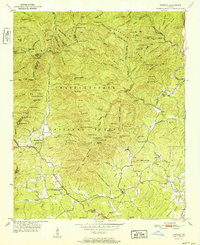
1952 Map of Cowrock
USGS Topo · Published 1952About this map
Chattahoochee National Forest dominates the northern half of this mid-century landscape, where the Appalachian Trail winds through high-altitude gaps like Tesnatee Gap and Hogpen Gap. The terrain is defined by the high ridges of Blue Ridge and Hickorynut Mtn, feeding water into the headwaters of the Chattahoochee River. In the lower elevations to the south, the settlement pattern centers on the small communities of Loudsville and Tesnatee. This area is rich with local landmarks for genealogical research, including the Blue Ridge School, Lawrence Cemetery, and several rural meeting houses such as Corinth Church and Asbestos Church. The map details a transition from the protected forest wilderness and its landmarks like Dukes Creek Falls to the established agricultural and religious centers of White County at the dawn of the 1950s.
Find a feature on this map
125 named features on this map. Tap any name to fly to it.
Don’t see what you’re looking for? This feature index may not catch every label — zoom into the map to look around manually.
Map Details
Editions of this 1952 Cowrock Map
2 editions found
Other maps of this area

1886 · Dahlonega
USGS Topo · 1:125,000

1892 · Dahlonega
USGS Topo · 1:125,000

1896 · Dahlonega
USGS Topo · 1:125,000

1903 · Dahlonega
USGS Topo · 1:125,000

1935 · Coosa Bald
USGS Topo · 1:24,000

1935 · Cowrock
USGS Topo · 1:24,000

1935 · Tray Mountain
USGS Topo · 1:24,000

1935 · Jacks Gap
USGS Topo · 1:24,000
1935 · Neels Gap
USGS Topo · 1:24,000

1938 · Cowrock
USGS Topo · 1:24,000