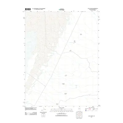
2011 Map of Cox Canyon
USGS Topo · Published 2011About this map
Silver Hill Creek and a network of desert drainages define this Churchill County landscape as it was documented in 2011. The terrain is marked by a series of deep canyons, including Cox Canyon, Silver Hill Canyon, and Lambing Canyon, which illustrate the complex natural topography of the Great Basin region. This survey captures a specific hydrological profile of the area, noting vital desert water sources such as High Rock Spring, Jobs Canyon Spring, and Mill Spring. The presence of Big Water in the western section suggests seasonal or low-lying accumulation areas typical of this arid environment. Tracing the primitive roads through Dry Canyon and Poco Canyon, researchers can observe the sparse infrastructure that supports land management and ranching access across these alluvial fans and mountain slopes.
Find a feature on this map
13 named features on this map. Tap any name to fly to it.
Don’t see what you’re looking for? This feature index may not catch every label — zoom into the map to look around manually.
Map Details
Editions of this 2011 Cox Canyon Map
This is the sole edition of this map. No revisions or reprints were ever made.
Other maps of this area

1908 · Carson Sink
USGS Topo · 1:250,000

1910 · Carson Sink
USGS Topo · 1:250,000

1957 · Reno
USGS Topo · 1:250,000

1959 · Reno
USGS Topo · 1:250,000

1960 · Reno
USGS Topo · 1:250,000

1966 · Dixie Hot Springs
USGS Topo · 1:62,500
1969 · Lone Rock SW
USGS Topo · 1:24,000

1969 · Cox Canyon
USGS Topo · 1:24,000

1969 · Table Mtn
USGS Topo · 1:24,000

1969 · Pintail Bay
USGS Topo · 1:24,000