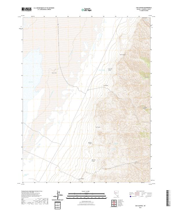
2021 Map of Cox Canyon
USGS Topo · Published 2021About this map
The eastern margins of the Carson Sink meet the sharp ascent of the Stillwater Range in this desert landscape. This area is defined by the hydrologic transition from the vast alkaline flats of the sink to the steep, drainage-carved slopes of the mountains. Several vital water sources are tucked into these canyons, including Jobs Canyon Spring, High Rock Spring, and Mill Spring. Human intervention in the natural drainage is visible through the Goose Lake Bypass, which cuts across the flats toward the Big Water area. The naming of features like Lambing Canyon and Silver Hill reflects the traditional land uses of ranching and prospecting that have historically characterized this part of Churchill County. Steep elevation changes are concentrated in the east, where Cox Canyon and Kent Canyon provide rugged access points into the high country from the basin floor.
Find a feature on this map
24 named features on this map. Tap any name to fly to it.
Don’t see what you’re looking for? This feature index may not catch every label — zoom into the map to look around manually.
Map Details
Editions of this 2021 Cox Canyon Map
This is the sole edition of this map. No revisions or reprints were ever made.
Other maps of this area

1908 · Carson Sink
USGS Topo · 1:250,000

1910 · Carson Sink
USGS Topo · 1:250,000

1957 · Reno
USGS Topo · 1:250,000

1959 · Reno
USGS Topo · 1:250,000

1960 · Reno
USGS Topo · 1:250,000

1966 · Dixie Hot Springs
USGS Topo · 1:62,500
1969 · Lone Rock SW
USGS Topo · 1:24,000

1969 · Cox Canyon
USGS Topo · 1:24,000

1969 · Table Mtn
USGS Topo · 1:24,000

1969 · Pintail Bay
USGS Topo · 1:24,000