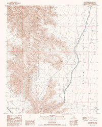
1987 Map of Coxcomb Mts
USGS Topo · Published 1987About this map
The Coxcomb Mountains dominate this 1987 survey, forming a stark geographic boundary between the Palen Valley to the east and the protected lands of the Joshua Tree National Monument Wilderness to the west. This arid landscape is defined by its critical infrastructure, most notably the Colorado River Aqueduct which skirts the mountain range and follows the lowlands of the Chuckwalla Valley. The presence of several prospects in the northern slopes suggests late-century mineral interest, while a network of 4wd tracks and a prominent Trans Line indicate the region's role as a corridor for utility and transit. Engineering details like a siphon and a protective levee system highlight the intensive management of water resources across this desert terrain.
Find a feature on this map
15 named features on this map. Tap any name to fly to it.
Don’t see what you’re looking for? This feature index may not catch every label — zoom into the map to look around manually.
Map Details
Editions of this 1987 Coxcomb Mts Map
This is the sole edition of this map. No revisions or reprints were ever made.
Other maps of this area

1942 · Amboy
USGS Topo · 1:250,000

1943 · Amboy
USGS Topo · 1:250,000

1943 · Cadiz Valley
USGS Topo · 1:62,500

1943 · Iron Mountains
USGS Topo · 1:62,500

1943 · Coxcomb Mountains
USGS Topo · 1:62,500

1944 · Coxcomb Mountains
USGS Topo · 1:62,500

1952 · Palen Mountains
USGS Topo · 1:62,500

1954 · Salton Sea
USGS Topo · 1:250,000

1954 · Needles
USGS Topo · 1:250,000

1955 · Salton Sea
USGS Topo · 1:250,000