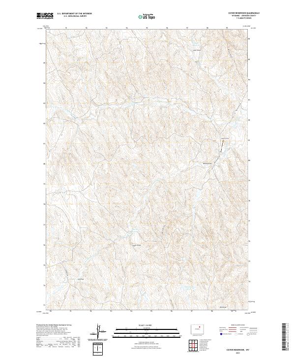
2021 Map of Coyer Reservoir
USGS Topo · Published 2021About this map
Coyer Reservoir and the surrounding high plains of Johnson County define this specialized landscape of water management and remote grazing land. In a region where seasonal moisture is critical, the map documents a series of man-made impoundments including Iberlin Reservoir and Flaxa Number 1 Reservoir, which capture runoff from the complex network of ephemeral drainages. The local geography is etched by numerous named draws such as Whisky Draw, Goble Draw, and Joe Draw, which feed into the N Fork Fourmile Creek and South Fork Fourmile Creek. The Iberlin Strip and the winding Iberlin 4-Mile Road indicate the long-standing ranching presence of the Iberlin family in this part of Wyoming. This map serves as a detailed record of land use and water rights in a part of the West where topography and access are dictated by the flow of the Fourmile Creek watershed.
Find a feature on this map
18 named features on this map. Tap any name to fly to it.
Don’t see what you’re looking for? This feature index may not catch every label — zoom into the map to look around manually.
Map Details
Editions of this 2021 Coyer Reservoir Map
This is the sole edition of this map. No revisions or reprints were ever made.
Other maps of this area

1953 · Hoe Ranch
USGS Topo · 1:24,000

1955 · Sheridan
USGS Topo · 1:250,000

1955 · Arminto
USGS Topo · 1:250,000

1958 · Sheridan
USGS Topo · 1:250,000

1958 · Arminto
USGS Topo · 1:250,000

1961 · Provence Ranch
USGS Topo · 1:24,000

1961 · Elaine Draw
USGS Topo · 1:24,000

1962 · Sheridan
USGS Topo · 1:250,000

1962 · Arminto
USGS Topo · 1:250,000
1972 · Crazy Woman Ranch
USGS Topo · 1:24,000