
1971 Map of Coyote Draw
USGS Topo · Published 1974About this map
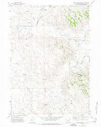
Burlington Northern rail lines cut a diagonal path through this Campbell County landscape, marking the industrial importance of the region's energy resources in the early 1970s. The terrain is defined by a dense network of drainage draws and reservoirs, reflecting the vital management of water in this semi-arid environment. Named features like Coal Mine Draw and Gold Mine Draw provide clear evidence of the area's mineral prospects, while the surrounding land is dotted with numerous oil wells and drill holes. Notable landmarks such as Sharp Butte rise above the complex system of coulees, including Lee Draw and Dry Donkey Creek. Small-scale water storage is prevalent throughout the survey area, seen in Coyote Res, Drum Res, and Kelly Res, which support the rural economy between Timber Creek and Piney Creek.
Find a feature on this map
26 named features on this map. Tap any name to fly to it.
Don’t see what you’re looking for? This feature index may not catch every label — zoom into the map to look around manually.
Map Details
Editions of this 1971 Coyote Draw Map
This is the sole edition of this map. No revisions or reprints were ever made.
Other maps of this area

1954 · Gillette
USGS Topo · 1:250,000

1955 · Gillette
USGS Topo · 1:250,000

1958 · Gillette
USGS Topo · 1:250,000

1962 · Gillette
USGS Topo · 1:250,000

1971 · Coon Track Creek
USGS Topo · 1:24,000

1971 · The Gap SW
USGS Topo · 1:24,000

1971 · Whitetail Creek
USGS Topo · 1:24,000

1971 · Rozet
USGS Topo · 1:24,000

1971 · Gillette East
USGS Topo · 1:24,000
1971 · Saddle Horse Butte
USGS Topo · 1:24,000