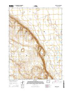
2014 Map of Coyote Gap
USGS Topo · Published 2014About this map
Coyote Gap serves as a prominent geographical pass through the escarpment that transitions between the high desert plateaus and the broad expanse of the Catlow Valley in southeastern Oregon. This 2014 survey documents a land defined by high relief and seasonal hydrology, where Garrison Lake sits on the eastern edge of the quadrangle. A significant historical trace is preserved in the northwest corner, where the Old Military Rd cuts across the sagebrush-covered terrain. The map's detailed topography reveals the dramatic descent from the upland rims into the valley floor, illustrating the natural corridors used for travel in this arid corner of Harney County.
Find a feature on this map
10 named features on this map. Tap any name to fly to it.
Don’t see what you’re looking for? This feature index may not catch every label — zoom into the map to look around manually.
Map Details
Editions of this 2014 Coyote Gap Map
This is the sole edition of this map. No revisions or reprints were ever made.
Other maps of this area

1955 · Adel
USGS Topo · 1:250,000

1957 · Adel
USGS Topo · 1:250,000

1958 · Adel
USGS Topo · 1:250,000

1962 · Adel
USGS Topo · 1:250,000

1971 · Fish Fin Rim
USGS Topo · 1:24,000

1971 · Square Mountain
USGS Topo · 1:24,000

1971 · Surveyors Lake
USGS Topo · 1:24,000

1971 · Blitzen
USGS Topo · 1:24,000

1971 · Coyote Gap SE
USGS Topo · 1:24,000

1971 · Garrison Lake
USGS Topo · 1:24,000