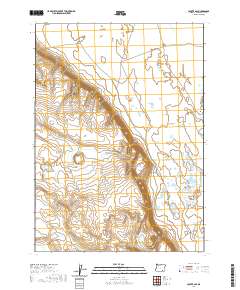
2020 Map of Coyote Gap
USGS Topo · Published 2020About this map
Catlow Valley dominates this high desert landscape in Harney County, characterized by its wide basin and distinct topographical transitions. A defining human mark on the terrain is the historic corridor of the Old Military Rd, which cuts across the northern reaches of the quadrangle. This route represents a significant era of frontier transportation, linking remote outposts across the Great Basin. The terrain is further defined by Coyote Gap, a natural passage where the elevation changes abruptly between the valley floor and the surrounding uplands. The mapping captures a moment of modern land management, showing the precise township and range boundaries that continue to organize this sparsely populated region of southeastern Oregon.
Find a feature on this map
9 named features on this map. Tap any name to fly to it.
Don’t see what you’re looking for? This feature index may not catch every label — zoom into the map to look around manually.
Map Details
Editions of this 2020 Coyote Gap Map
This is the sole edition of this map. No revisions or reprints were ever made.
Other maps of this area

1955 · Adel
USGS Topo · 1:250,000

1957 · Adel
USGS Topo · 1:250,000

1958 · Adel
USGS Topo · 1:250,000

1962 · Adel
USGS Topo · 1:250,000

1971 · Fish Fin Rim
USGS Topo · 1:24,000

1971 · Square Mountain
USGS Topo · 1:24,000

1971 · Surveyors Lake
USGS Topo · 1:24,000

1971 · Blitzen
USGS Topo · 1:24,000

1971 · Coyote Gap SE
USGS Topo · 1:24,000

1971 · Garrison Lake
USGS Topo · 1:24,000