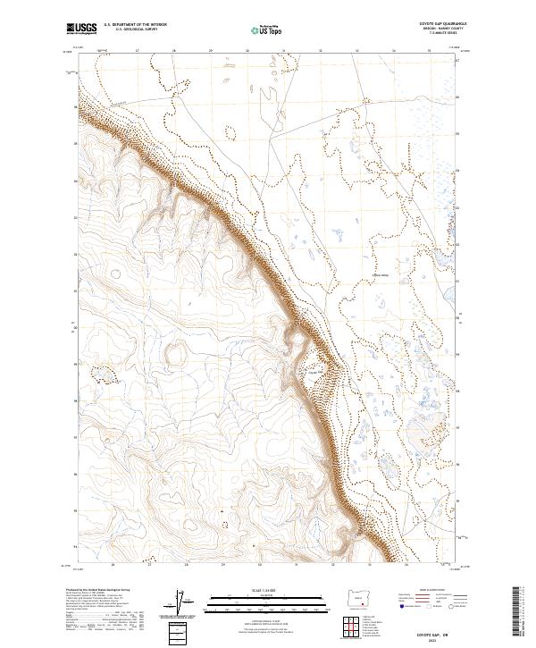
2023 Map of Coyote Gap
USGS Topo · Published 2023About this map
Coyote Gap serves as a prominent geographic break between the high desert plateaus of southeastern Oregon. This 2023 survey illustrates the dramatic escarpment where the western highlands drop away into the expansive Catlow Valley. A trace of regional transit history persists in the northern portion of the map with the Old Military Rd, a route that historically connected remote outposts across the high desert. The landscape is defined by its isolation and the stark contrast between the structured sections of the Public Land Survey System, such as t36s r31e, and the open, basin-like floor of the valley to the east. This modern topographic record captures the enduring pathways and geological landmarks of this remote part of Harney County.
Find a feature on this map
9 named features on this map. Tap any name to fly to it.
Don’t see what you’re looking for? This feature index may not catch every label — zoom into the map to look around manually.
Map Details
Editions of this 2023 Coyote Gap Map
This is the sole edition of this map. No revisions or reprints were ever made.
Other maps of this area

1955 · Adel
USGS Topo · 1:250,000

1957 · Adel
USGS Topo · 1:250,000

1958 · Adel
USGS Topo · 1:250,000

1962 · Adel
USGS Topo · 1:250,000

1971 · Fish Fin Rim
USGS Topo · 1:24,000

1971 · Square Mountain
USGS Topo · 1:24,000

1971 · Surveyors Lake
USGS Topo · 1:24,000

1971 · Blitzen
USGS Topo · 1:24,000

1971 · Coyote Gap SE
USGS Topo · 1:24,000

1971 · Garrison Lake
USGS Topo · 1:24,000