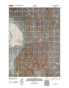
2011 Map of Coyote Lake East
USGS Topo · Published 2011About this map
Coyote Lake dominates the western portion of this 2011 survey in Malheur County, Oregon, its expansive bed appearing as a prominent alkali flat within the high desert landscape. The terrain rises to the east toward the Crooked Creek Range, where the topography becomes defined by the drainages that feed into the basin during rare precipitation events. One such drainage is Duck Creek, which enters the quadrangle from the south. This map reflects the remote and arid character of the southeastern Oregon backcountry at the start of the 21st century, showing the sparse road network of 4WD tracks and local routes that provide the only access across this quiet corner of the Great Basin.
Find a feature on this map
3 named features on this map. Tap any name to fly to it.
Don’t see what you’re looking for? This feature index may not catch every label — zoom into the map to look around manually.
Map Details
Editions of this 2011 Coyote Lake East Map
This is the sole edition of this map. No revisions or reprints were ever made.
Other maps of this area

1955 · Jordan Valley
USGS Topo · 1:250,000

1955 · Adel
USGS Topo · 1:250,000

1957 · Adel
USGS Topo · 1:250,000

1957 · Jordan Valley
USGS Topo · 1:250,000

1958 · Adel
USGS Topo · 1:250,000

1958 · Jordan Valley
USGS Topo · 1:250,000

1962 · Adel
USGS Topo · 1:250,000
1980 · Flat Top Mtn
USGS Topo · 1:24,000

1980 · Rome State Airport
USGS Topo · 1:24,000

1981 · Coyote Lake West
USGS Topo · 1:24,000