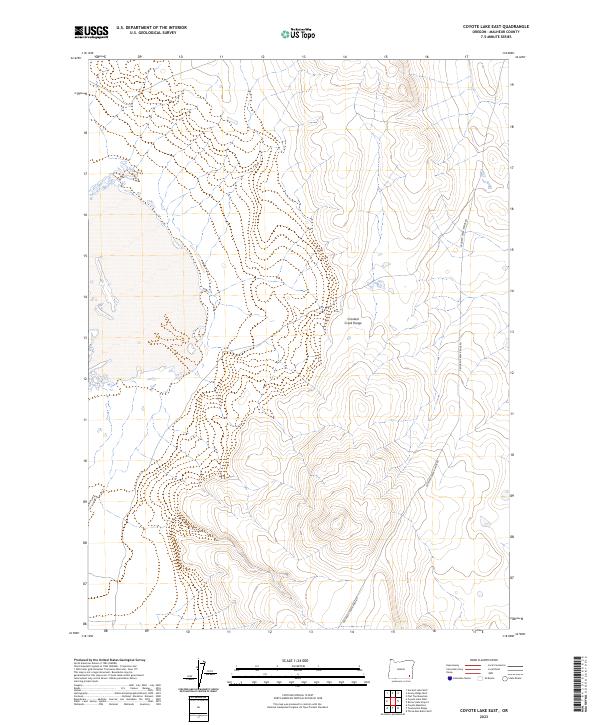
2023 Map of Coyote Lake East
USGS Topo · Published 2023About this map
Crooked Creek Range dominates this corner of Malheur County, providing a high-desert topographical profile of the southeastern Oregon landscape. This recent survey by the U.S. Geological Survey documents the region’s topography and limited infrastructure, which is primarily defined by the Crooked Creek Range Rd winding through the basin and range terrain. The map details a vast area of public lands and topographical relief within the Oregon High Desert, emphasizing the isolation and distinctive geomorphology of the area. It is a modern record of the unchanged character of this remote part of the state, focusing on elevation contours and the few established access routes that cross the high-altitude terrain.
Find a feature on this map
6 named features on this map. Tap any name to fly to it.
Don’t see what you’re looking for? This feature index may not catch every label — zoom into the map to look around manually.
Map Details
Editions of this 2023 Coyote Lake East Map
This is the sole edition of this map. No revisions or reprints were ever made.
Other maps of this area

1955 · Jordan Valley
USGS Topo · 1:250,000

1955 · Adel
USGS Topo · 1:250,000

1957 · Adel
USGS Topo · 1:250,000

1957 · Jordan Valley
USGS Topo · 1:250,000

1958 · Adel
USGS Topo · 1:250,000

1958 · Jordan Valley
USGS Topo · 1:250,000

1962 · Adel
USGS Topo · 1:250,000
1980 · Flat Top Mtn
USGS Topo · 1:24,000

1980 · Rome State Airport
USGS Topo · 1:24,000

1981 · Coyote Lake West
USGS Topo · 1:24,000