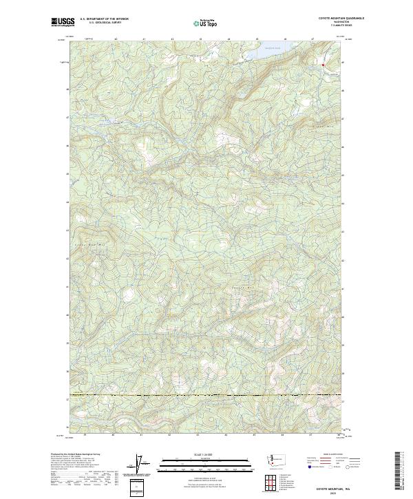
2023 Map of Coyote Mountain
USGS Topo · Published 2023About this map
Swofford Valley and the surrounding high country define this portion of the Pacific Northwest, where the landscape is marked by industrial history and drainage systems. The northern edge of the map features the Long-Bell Mill Pond and Swofford Pond, points of interest that reflect the region's managed waterways and timber-related infrastructure. Moving south, the terrain rises toward significant peaks including Coyote Mtn, Green Mtn, and the curiously named Crazy Man Mtn. A complex network of drainage basins is formed by the South Fork Winston Creek and Devils Creek, eventually feeding into the Green River along the southern boundary. This map also delineates the border between Lewis Co and Cowlitz Co, providing a clear view of how political lines bisect these wooded ridges and valleys.
Find a feature on this map
25 named features on this map. Tap any name to fly to it.
Don’t see what you’re looking for? This feature index may not catch every label — zoom into the map to look around manually.
Map Details
Editions of this 2023 Coyote Mountain Map
This is the sole edition of this map. No revisions or reprints were ever made.
Other maps of this area

1916 · Chehalis
USGS Topo · 1:125,000

1919 · Mount St Helens
USGS Topo · 1:125,000

1937 · Eatonville
USGS Topo · 1:125,000

1942 · Toutle
USGS Topo · 1:62,500

1943 · Willapa
USGS Topo · 1:62,500

1953 · Hoquiam
USGS Topo · 1:250,000

1953 · Toutle
USGS Topo · 1:62,500

1953 · Elk Rock
USGS Topo · 1:62,500

1954 · Onalaska
USGS Topo · 1:62,500

1957 · Hoquiam
USGS Topo · 1:250,000