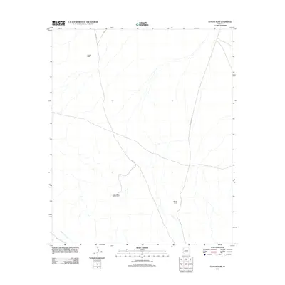
2011 Map of Coyote Peak
USGS Topo · Published 2011About this map
Coyote Peak rises as a prominent landmark in this arid stretch of La Paz County, anchored by the jagged profile of the Little Horn Mountains to the south. The landscape is defined by its drainage patterns and lonely desert corridors, where Cementosa Wash cuts across the southwest corner. Transportation in this part of Arizona relies on a handful of long-distance desert tracks, including Hovatter Rd and the Vicksburg Rd, which converge and cross the open terrain. The mapping of Royal Arch in the southeast quadrant provides a specific point of interest for those tracking natural geological formations. This 2011 survey reflects the enduring character of the Sonoran landscape, where modern roads follow traditional routes through wide basins and along the edges of volcanic ranges.
Find a feature on this map
7 named features on this map. Tap any name to fly to it.
Don’t see what you’re looking for? This feature index may not catch every label — zoom into the map to look around manually.
Map Details
Editions of this 2011 Coyote Peak Map
This is the sole edition of this map. No revisions or reprints were ever made.
Other maps of this area

1942 · Vicksburg
USGS Topo · 1:250,000

1954 · Phoenix
USGS Topo · 1:250,000

1957 · Phoenix
USGS Topo · 1:250,000

1958 · Phoenix
USGS Topo · 1:250,000

1960 · Phoenix
USGS Topo · 1:250,000

1961 · Hope
USGS Topo · 1:62,500

1962 · Little Horn Mts
USGS Topo · 1:62,500

1962 · Kofa Butte
USGS Topo · 1:62,500

1962 · Vicksburg
USGS Topo · 1:62,500

1969 · Phoenix
USGS Topo · 1:250,000