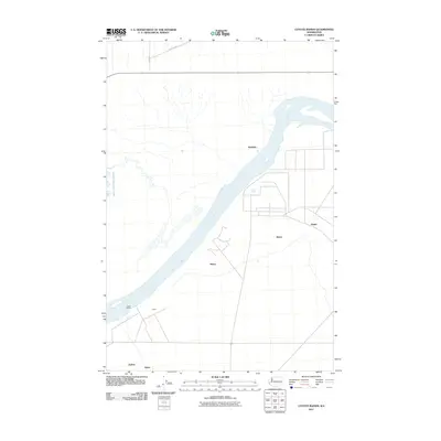
2011 Map of Coyote Rapids
USGS Topo · Published 2011About this map
The Columbia River dominates this portion of Benton County, flowing past the turbulent Coyote Rapids and the settlement of Allard. This area reflects a landscape of dispersed settlements and infrastructure, where local names like Nancy, Bettie, and Ginger identify specific points of interest or habitation east of the river. To the north, Wahluke sits near the riverbanks, while the southern margin includes the named locations of Audrey and Helen. The terrain is characterized by the presence of Saddle Mountain Lake to the west, with a road network including Road 23 SW providing access across the high desert plains. The arrangement of these specifically named locations suggests a history of localized agricultural or residential development along the river's path through the Hanford region.
Find a feature on this map
11 named features on this map. Tap any name to fly to it.
Don’t see what you’re looking for? This feature index may not catch every label — zoom into the map to look around manually.
Map Details
Editions of this 2011 Coyote Rapids Map
This is the sole edition of this map. No revisions or reprints were ever made.
Other maps of this area

1911 · Red Rock
USGS Topo · 1:62,500

1916 · Coyote Rapids
USGS Topo · 1:62,500

1923 · Corfu
USGS Topo · 1:62,500

1924 · Hanford
USGS Topo · 1:62,500

1950 · Smyrna
USGS Topo · 1:62,500

1951 · Smyrna
USGS Topo · 1:62,500

1951 · Corfu
USGS Topo · 1:62,500

1951 · Hanford
USGS Topo · 1:62,500

1951 · Coyote Rapids
USGS Topo · 1:62,500

1953 · Walla Walla
USGS Topo · 1:250,000