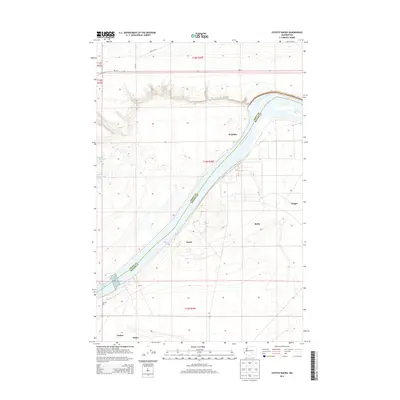
2014 Map of Coyote Rapids
USGS Topo · Published 2014About this map
The Columbia River carves a path through the landscape of the Grant and Benton County border, defining the development of this riverfront corridor. In this 2014 survey, the area around the Coyote Rapids shows a scattering of small local nodes including Wahluke, Allard, and Nancy. The terrain is characterized by its proximity to the water, with the river serving as the primary geographical anchor for the surrounding agricultural and infrastructure patterns. Further inland, Saddle Mountain Lake and several designated spots like Ginger and Bettie dot the landscape, alongside industry-related features such as a Gravel Pit. The map captures a moment in the modern era of the Columbia Basin, where state routes like Wa-24 provide the backbone for regional connectivity between these riverside points.
Find a feature on this map
21 named features on this map. Tap any name to fly to it.
Don’t see what you’re looking for? This feature index may not catch every label — zoom into the map to look around manually.
Map Details
Editions of this 2014 Coyote Rapids Map
This is the sole edition of this map. No revisions or reprints were ever made.
Other maps of this area

1911 · Red Rock
USGS Topo · 1:62,500

1916 · Coyote Rapids
USGS Topo · 1:62,500

1923 · Corfu
USGS Topo · 1:62,500

1924 · Hanford
USGS Topo · 1:62,500

1950 · Smyrna
USGS Topo · 1:62,500

1951 · Smyrna
USGS Topo · 1:62,500

1951 · Corfu
USGS Topo · 1:62,500

1951 · Hanford
USGS Topo · 1:62,500

1951 · Coyote Rapids
USGS Topo · 1:62,500

1953 · Walla Walla
USGS Topo · 1:250,000