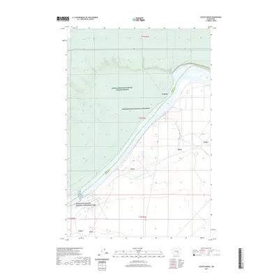
2020 Map of Coyote Rapids
USGS Topo · Published 2020About this map
The Columbia River carves a significant path through this section of the inland Northwest, serving as the primary boundary between Grant and Benton Counties. This landscape is defined by its conservation and military heritage, encompassing portions of the Manhattan Project National Historical Park and the Hanford Reach National Monument. The presence of the Saddle Mountain National Wildlife Refuge to the north underscores the region's role as a protected corridor. Small named locations like Wahluke, Nancy, Bettie, and Ginger are interspersed throughout the river valley, while water management features such as the Hanford Ditch and the Wahluke Wasteway indicate the complex engineering required to support human activity and agriculture in this arid environment. The map details a mix of rural infrastructure and significant federal land designations that shaped the mid-20th-century development of the region.
Find a feature on this map
19 named features on this map. Tap any name to fly to it.
Don’t see what you’re looking for? This feature index may not catch every label — zoom into the map to look around manually.
Map Details
Editions of this 2020 Coyote Rapids Map
This is the sole edition of this map. No revisions or reprints were ever made.
Other maps of this area

1911 · Red Rock
USGS Topo · 1:62,500

1916 · Coyote Rapids
USGS Topo · 1:62,500

1923 · Corfu
USGS Topo · 1:62,500

1924 · Hanford
USGS Topo · 1:62,500

1950 · Smyrna
USGS Topo · 1:62,500

1951 · Smyrna
USGS Topo · 1:62,500

1951 · Corfu
USGS Topo · 1:62,500

1951 · Hanford
USGS Topo · 1:62,500

1951 · Coyote Rapids
USGS Topo · 1:62,500

1953 · Walla Walla
USGS Topo · 1:250,000