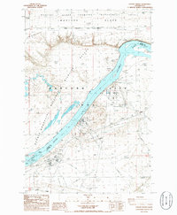
1986 Map of Coyote Rapids
USGS Topo · Published 1986About this map
The Columbia River cuts a deep path through the mid-1980s landscape of the Hanford Site (DOE), separating the restricted research areas of Benton Co from the agricultural reaches of Grant Co. This period reflects the transition of the region, where the industrial presence of the Department of Energy is balanced by the conservation efforts at the Hanford National Wildlife Refuge. The map identifies localized points of interest such as Nancy, Bettie, and Ginger, which appear as distinct markers within the site's boundaries. To the north, the Wahluke Slope and the Saddle Mountain range dominate the topography, with Saddle Mountain Lake and the Wahluke Slope Habitat Management Area occupying the high ground. Remnants of earlier transport routes are still visible via the Old Railroad Grade, providing clues to the era of settlement and trade before the establishment of the federal facility.
Find a feature on this map
25 named features on this map. Tap any name to fly to it.
Don’t see what you’re looking for? This feature index may not catch every label — zoom into the map to look around manually.
Map Details
Editions of this 1986 Coyote Rapids Map
This is the sole edition of this map. No revisions or reprints were ever made.
Other maps of this area

1911 · Red Rock
USGS Topo · 1:62,500

1916 · Coyote Rapids
USGS Topo · 1:62,500

1923 · Corfu
USGS Topo · 1:62,500

1924 · Hanford
USGS Topo · 1:62,500

1950 · Smyrna
USGS Topo · 1:62,500

1951 · Smyrna
USGS Topo · 1:62,500

1951 · Corfu
USGS Topo · 1:62,500

1951 · Hanford
USGS Topo · 1:62,500

1951 · Coyote Rapids
USGS Topo · 1:62,500

1953 · Walla Walla
USGS Topo · 1:250,000