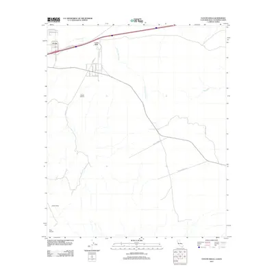
2012 Map of Coyote Wells
USGS Topo · Published 2012About this map
Ocotillo and Coyote Wells serve as the primary hubs in this arid stretch of Imperial County, California, just north of the international border. The landscape is defined by extensive drainage systems including Coyote Wash, S Fork Coyote Wash, and Yuha Wash, which carve through the desert floor towards the south. Transportation is dominated by the modern interstate corridor and the Evan Hewes Hwy, which parallel the older routes across the valley. To the southwest, the terrain becomes more dramatic as the flats give way to Davies Canyon, Davies Valley, and Pinto Canyon. Local connectivity is maintained through a network of named desert roads like Militar Rd and Anza Trail Rd, reflecting the area's legacy as a transit corridor. This survey documents the intersection of modern infrastructure and the geographic realities of the Yuha Desert in the early twenty-first century.
Find a feature on this map
26 named features on this map. Tap any name to fly to it.
Don’t see what you’re looking for? This feature index may not catch every label — zoom into the map to look around manually.
Map Details
Editions of this 2012 Coyote Wells Map
This is the sole edition of this map. No revisions or reprints were ever made.
Other maps of this area

1915 · El Centro
USGS Topo · 1:125,000

1931 · Carrizo
USGS Topo · 1:125,000

1939 · Jacumba
USGS Topo · 1:62,500

1940 · Plaster City
USGS Topo · 1:62,500

1940 · Coyote Wells
USGS Topo · 1:62,500

1942 · El Centro
USGS Topo · 1:250,000

1942 · Carrizo Mtn
USGS Topo · 1:62,500

1942 · Jacumba
USGS Topo · 1:62,500

1943 · Coyote Wells
USGS Topo · 1:62,500

1944 · Plaster City
USGS Topo · 1:62,500