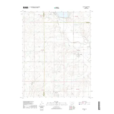
2018 Map of Coyville
USGS Topo · Published 2018About this map
Coyville serves as the central hub of this eastern Kansas landscape, situated near the confluence of several significant waterways. The Verdigris River and the Fall River define the local drainage patterns, with the northern reach of the map featuring the southern waters of Toronto Lake and Woodson Cove. The area is marked by a legacy of early settlement and rural life, evidenced by a high density of family and community burial grounds, including the Coyville Cem, Carlisle Cem, and Caley Cem.
Find a feature on this map
66 named features on this map. Tap any name to fly to it.
Don’t see what you’re looking for? This feature index may not catch every label — zoom into the map to look around manually.
Map Details
Editions of this 2018 Coyville Map
This is the sole edition of this map. No revisions or reprints were ever made.
Other maps of this area

1885 · Eureka
USGS Topo · 1:125,000

1886 · Fredonia
USGS Topo · 1:125,000

1888 · Eureka
USGS Topo · 1:125,000

1894 · Fredonia
USGS Topo · 1:125,000

1894 · Eureka
USGS Topo · 1:125,000

1938 · Fredonia
USGS Topo · 1:62,500

1939 · Fredonia
USGS Topo · 1:48,000

1939 · Severy
USGS Topo · 1:62,500

1941 · Severy
USGS Topo · 1:62,500

1942 · Fredonia
USGS Topo · 1:62,500