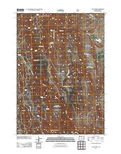
2011 Map of Craft Point
USGS Topo · Published 2011About this map
High-desert ranching and water management define this Harney County landscape, where livestock operations depend on a network of isolated springs and man-made impoundments. The cattle-country heritage is visible at the Pine Creek Cow Camp and the Dietrich Ranch, connected by rugged tracks like Dietrich Ranch Rd. Significant elevation markers such as Mount Tom and Elephant Butte rise above the drainage basins of Gould Creek and Pine Creek. To sustain activity in this arid environment, numerous reservoirs were established, including Miller Reservoir, Temple Reservoir, and Poer Reservoir. These water sources, along with named outlets like Thompson Spring and Craft Spring, illustrate the essential infrastructure required for remote Oregon land use in the early 21st century.
Find a feature on this map
31 named features on this map. Tap any name to fly to it.
Don’t see what you’re looking for? This feature index may not catch every label — zoom into the map to look around manually.
Map Details
Editions of this 2011 Craft Point Map
This is the sole edition of this map. No revisions or reprints were ever made.
Other maps of this area

1955 · Burns
USGS Topo · 1:250,000

1958 · Burns
USGS Topo · 1:250,000

1959 · Burns
USGS Topo · 1:250,000

1959 · Harney
USGS Topo · 1:62,500

1961 · Calamity Butte
USGS Topo · 1:62,500

1968 · Van
USGS Topo · 1:62,500

1973 · Buchanan
USGS Topo · 1:24,000
1978 · Stinkingwater Pass
USGS Topo · 1:24,000

1978 · Stinkingwater Mountains
USGS Topo · 1:100,000
1990 · Calamity Butte
USGS Topo · 1:24,000